Public Use Study
The Mairangi Bay Beach Reserve Public Use Study assessed how the beach and reserve areas are currently used to guide future design and management decisions, including the potential relocation of the Surf Lifesaving Club facility.
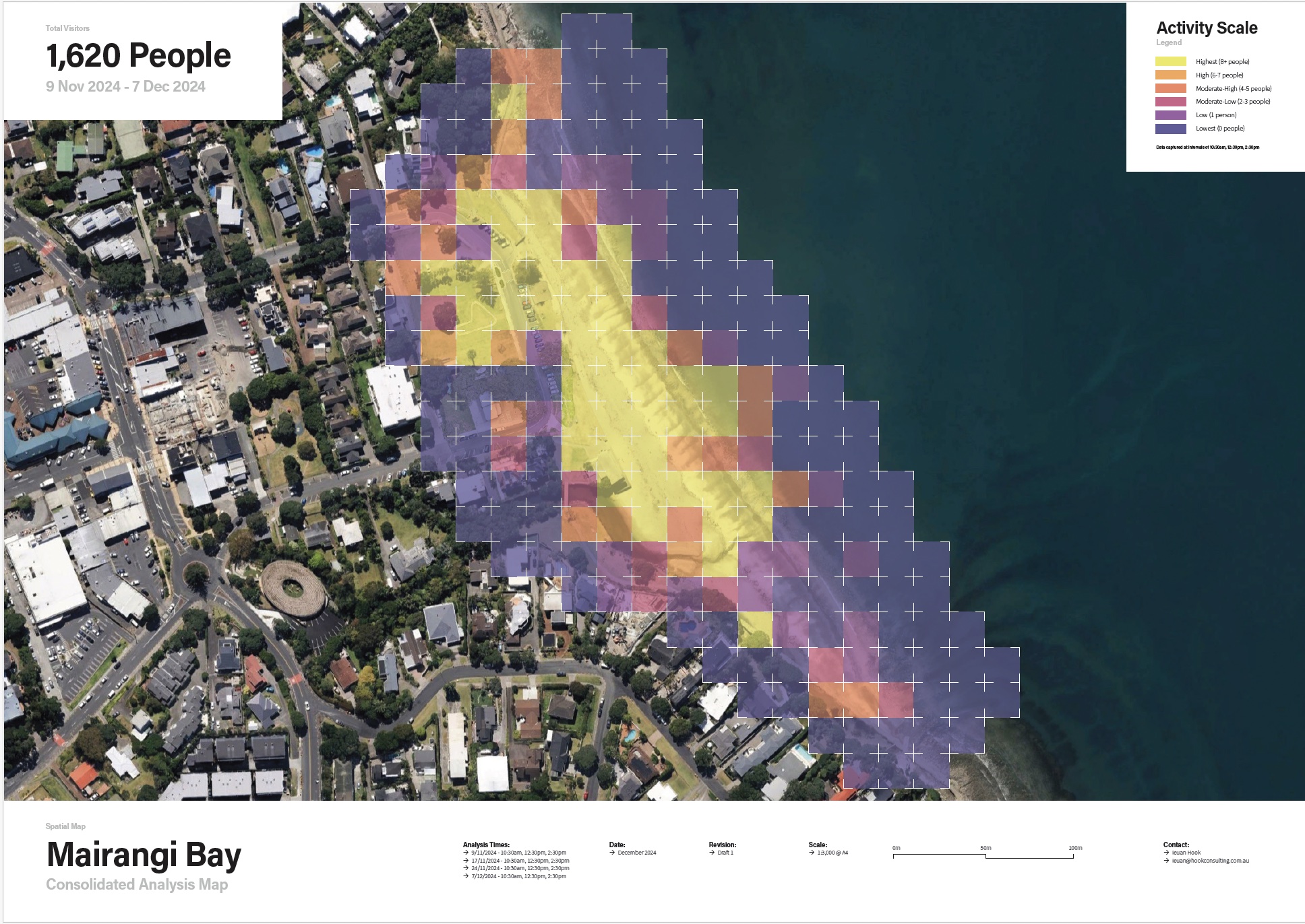
Conducted over four days in November and December 2024, the study area covered approximately 8,000 m², including the beach, foreshore reserve and the area surrounding the Surf Lifesaving Club.
Data was collected through drone flights, structured observation studies, and intercept surveys which captured visitor numbers, behaviours, activities, and preferences.
Drone imagery was turned into easy to understand heat maps, which showed the areas of the reserve were most used.
The research provided a detailed understanding of visitor demographics, peak use times, high-use areas, and key amenities valued by the community.